Navigation
Méditerranée

Navigation
Diaporama

Navigation


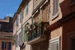
Cassis-Cassis bay
A fossil river between cliff and calanque
Cassis Bay is the product of a long geological history, one worth learning so that you don't sail the coast ignorant amidst such riches. Before diving into the cove or visiting the Cassis cellars, let us go back 100 million years...
Everything is quiet. The water, the stones... in this bay nothing seems to have ever changed. Everything seems always attuned to human scale—and never to a planetary scale.
Imagine Cassis Bay 100 million years ago. Roughly speaking, it was the opposite of what you will see today: instead of the sea, there was a continent, a mountain range that geologists call the Pyreneo-Provençal massif; instead of the land, there was the Alpine Sea, which would have flooded Avignon, Luberon, and Gap.
The rivers then flowed from south to north. A huge delta existed opposite Cassis and La Ciotat, and there it poured out its alluvia (sand and pebbles). "Pudding stones"—masses of pebbles "cemented" (like the raisins in a pudding) by siltstone debris—resulted: they formed part of Cap Canaille, and almost all of the Bec de l'Aigle.
And then sixty-five million years ago, everything began to change dramatically. Holes became bumps, and whatever towered above collapsed. The Maures and Esterel emerged, and the ancient range subsided. Corsica and Sardinia moved away from Provence, leaving a large gap. Then, seawater filled in the basins that had opened up, putting the Mediterranean south of Marseilles and Toulon. The ancestors of the Var and Durance rivers started to flow in the "right" direction.
Everything had taken on a familiar appearance; so then did sailing become possible? No way, skipper! Ten million years ago Africa collided with Europe. The Strait of Gibraltar closed up. The sea turned into shrinking salt lake. The water evaporated (significant salt deposits can be found down to depths of 2,000 m!). Coastal rivers eroded the coast’s steep slopes, and gorges and canyons were formed. These still exist, although now under water. One of them, perpendicular to the bay of Toulon, lets submarines arrive at their base without surfacing.
 And then five million years ago, Gibraltar opened up again. Mare Nostrum had returned.
During a more contemporary period—only 18,000 years ago—the level of the sea again dropped by as much as 125 m due to glaciation. Humans inhabited the Cosquer cave, at the foot of the present-day coves. Bison grazed on the pastures. The river water, which at times was highly acidic, cut deeply into the limestone cliffs. Then the ice melted and the sea rose again into these narrow valleys, creating these kinds of coves called “calanques”.
The two edges of Cassis Bay are Port Miou to the west and Cap Canaille to the east—separated only by a few nautical miles and 100 million years.
PORT MIOU
Near the city, the Port Miou calanque, the only one easily accessible to Cassis, has become a victim of its own success. A majority of the 800,000 annual visitors to all the calanques pass through it. And the 480 anchorages (30 of which are on moorings) are immediately snapped up. To protect the site, the Coastal Conservatory took possession of 132 hectares. All of the land bordering the calanque and the body of water itself have been included in the calanques listed site since 1 August 1975.
CAP CANAILLE
There's nothing rough about Cap Canaille, even though that’s what “canaille” means in modern French. The etymology of the name could come from the Latin "canalis mons" (mountain of aqueducts, Cape Canal), or from the Provençal "Cap Naïo" (mountain on the sea like a naiad).
There are paths (12 km) from Cassis to climb to the summit of this 399 m precipice, Europe’s highest sea cliff. But even if you have no interest in records, the views from both sides—towards Cassis Bay, over La Ciotat Bay, and even further—are magnificent.
- C.N.